AI-generated summary
This article mainly introduces Fog of World, an app used to record and display footprints, as well as other tools besides Fog of World that can help users obtain and process footprint data. The main content includes:
- It introduces the basic functions and features of Fog of World, such as multiple databases, snapshots, and various extension tools provided by the Fog Resource Library.
- It evaluates the user experience and after-sales service of Fog of World, and explains the reason for its relatively high pricing.
- It introduces some other footprint recording apps similar to Fog of World, such as LifeFootprint, LingganFootprint, etc.
- It details and reviews various tools for obtaining footprint data outside of Fog of World, including GPS Visualizer, gpx.studio, Footpath, Guru Maps, TwoBuLu, Flightradar24, etc.
- It briefly introduces some visualization solutions for displaying footprint data, such as AntV L7, dérive, etc.
- In general, this article comprehensively lists various tool choices for processing footprint data, providing a reference for users who like to record footprints.
Actually, I’ve been meaning to write an article about “Fog of World” for a long time. Coincidentally, in November last year, Fog of World also underwent a significant update. I created a new document and added some scattered content, but I kept procrastinating without sitting down properly to write it. It wasn’t until a few days ago when I saw an article on the homepage of a website called App+1 | Rond and Fog of World: The Legend of Zelda Map of the Real World (Chinese version only) that I was reminded. In this article, I want to introduce the changes in the Fog of World update, share some of my usage experiences, and organize some tools for handling traces outside of Fog of World.
Fog of World
Fog of World is an app used to explore the world. Launched in 2012, users can record their current tracks through location tracking. The map, covered by mist, gradually disperses as the user’s location moves, clearly displaying the percentage of the world explored and various achievements.
Coincidentally, as the Spring Festival approaches, ElijahLee detailed the mist in his article “As the Spring Festival Approaches, Use It to Clear the ‘Fog of World’ on the Way Home (Chinese version only)” after version 3.0. The author made significant changes to the overall UI, making achievements, passports, synchronization, medals, and other interfaces more modern. However, unfortunately, there were no major surprises in terms of functionality for users.
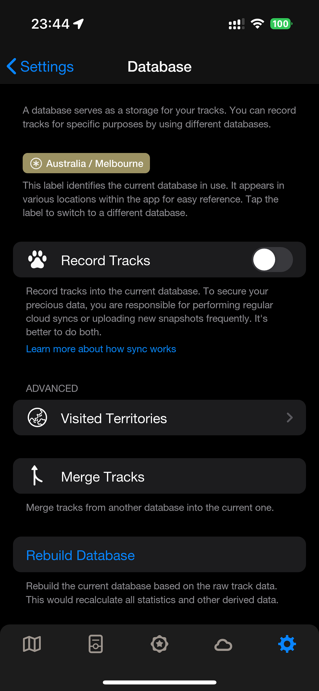
New Multi-Database and Snapshot Functionality
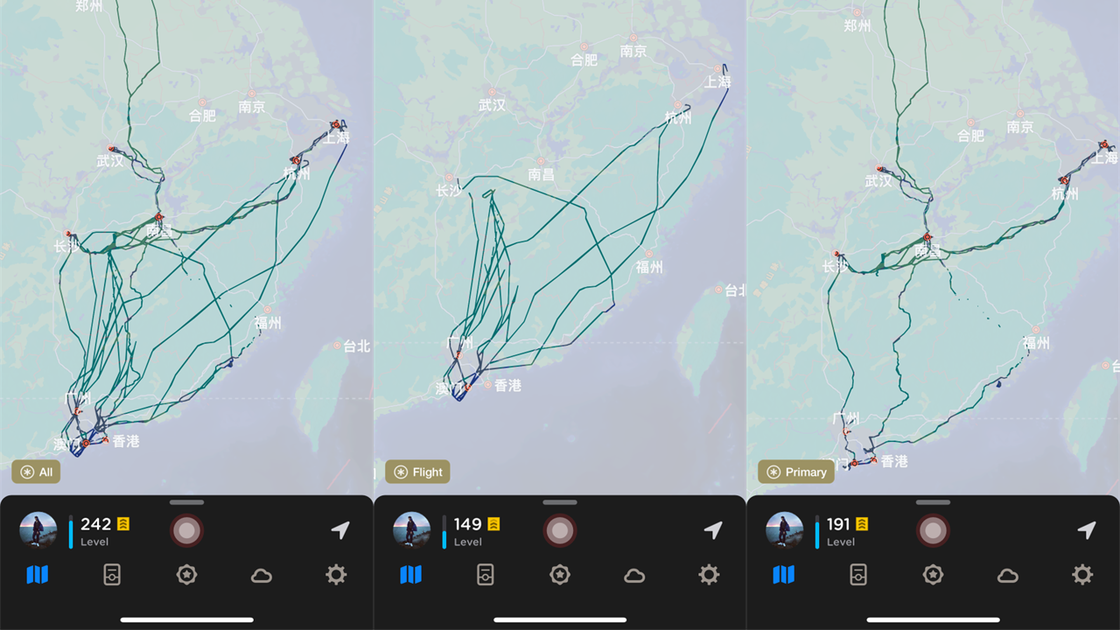
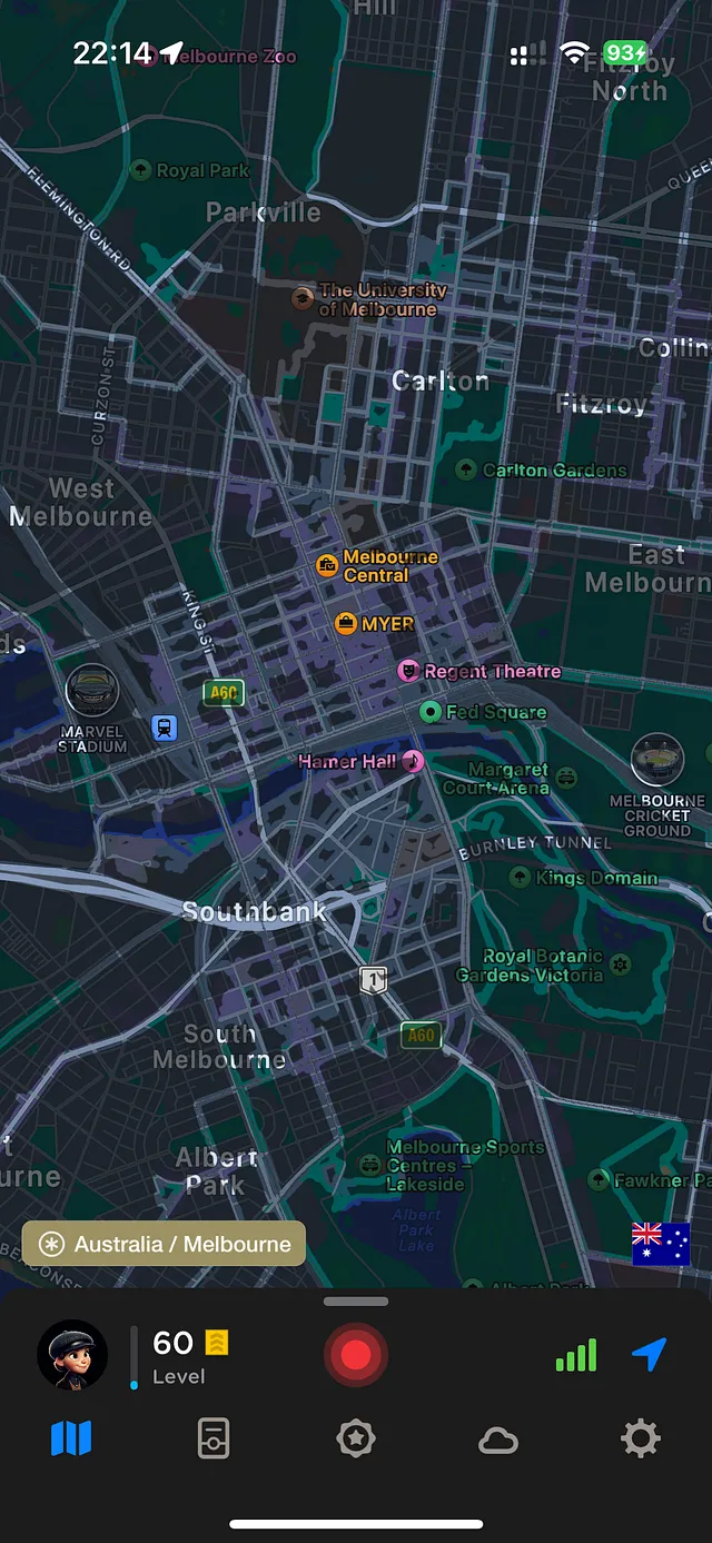
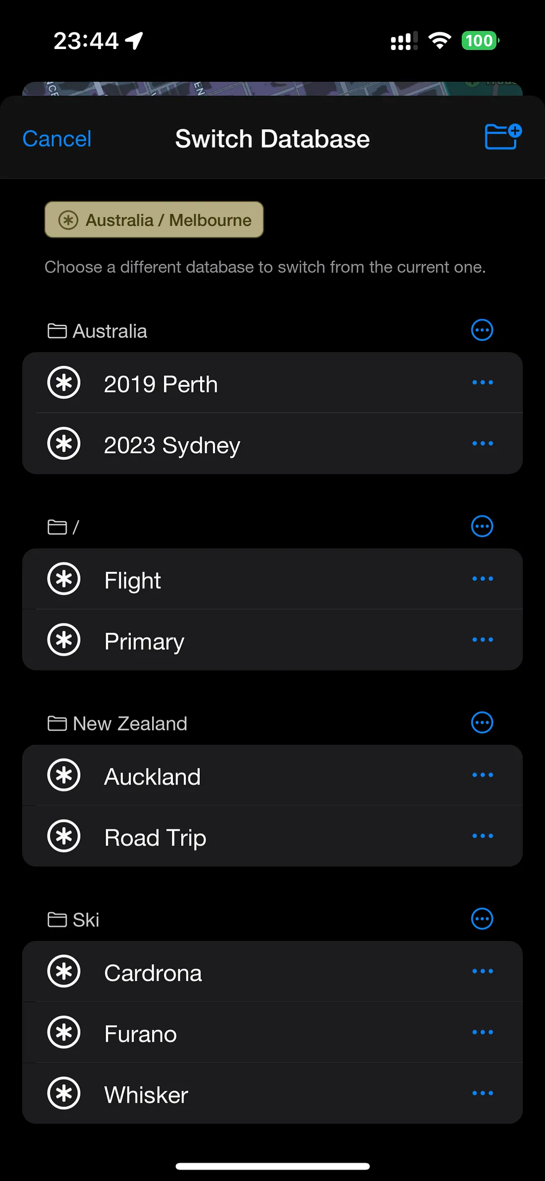
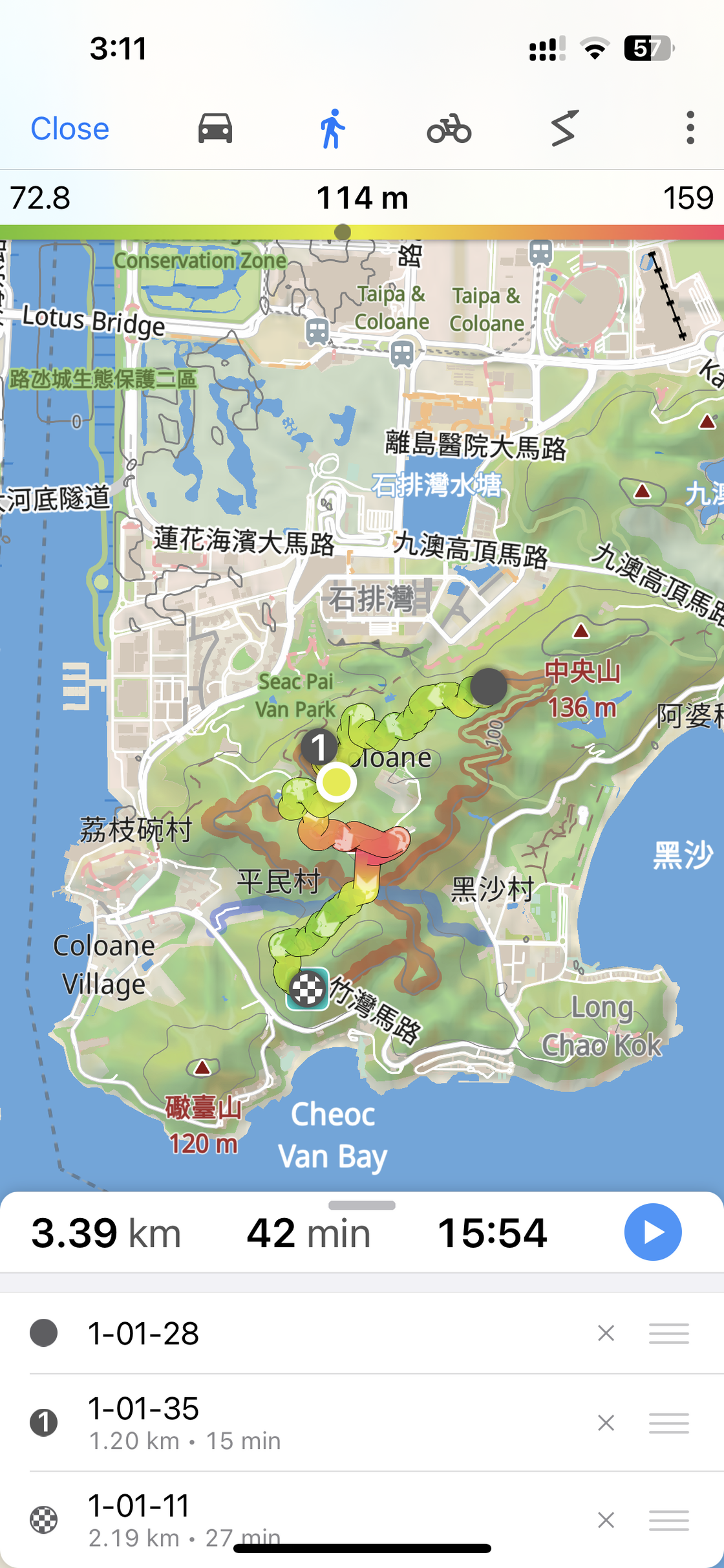
A year passed, during which the author also made some updates to the map display. Users can choose to make the map invisible or set it as opaque, among other options. By the end of November last year, Mist updated to version 3.6, introducing multi-databases and snapshots. For new users, the previous tracks that affected the overall aesthetics no longer need to be hesitated over whether to record or worry about erasing them in the future. Multi-databases allow users to store different types of tracks in different databases. In addition to different types, locations, times, etc., users can decide how to use multiple databases according to their needs.
swipe left/right to view more images
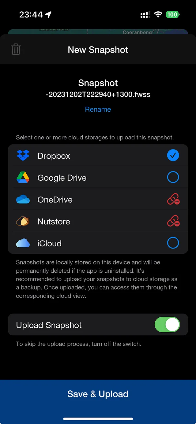
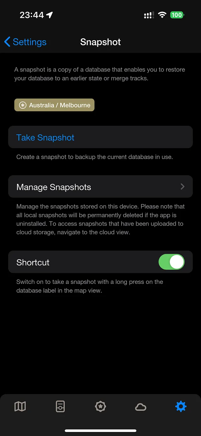
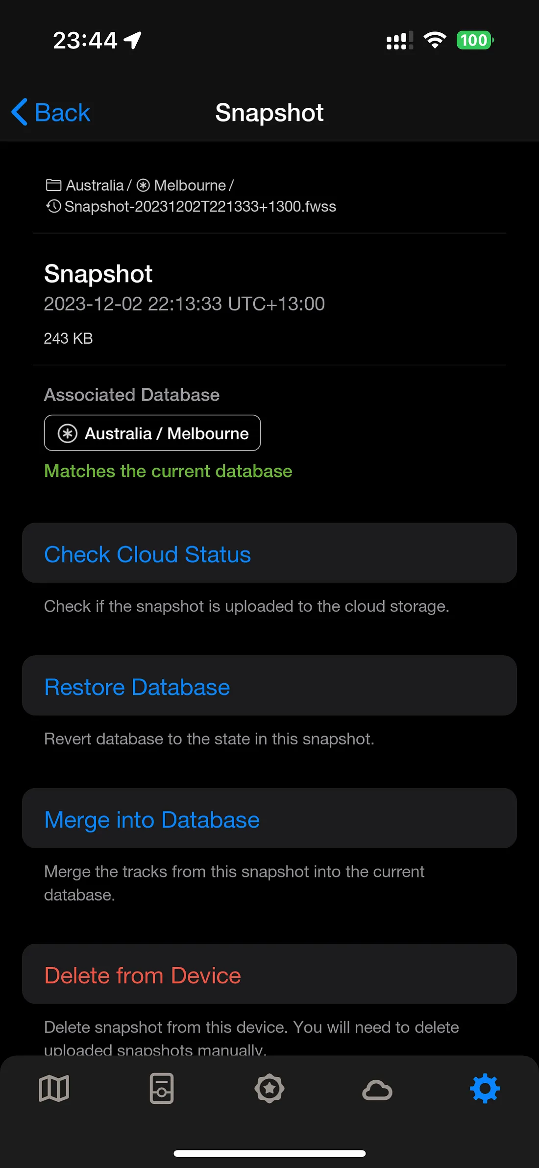
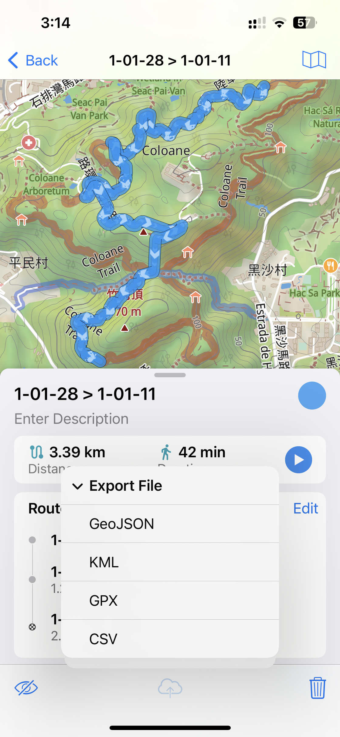
The snapshot feature complements the previous backup function, which, due to the Fog’s backup mechanism, made it cumbersome to modify tracks when needed. Now users can quickly restore their database to the state it was in at the time the snapshot was taken. As a single file, snapshots are also more convenient to transfer between devices compared to backup files. Currently, I use snapshots as backups. In the author’s updated blog post, the concept of a time machine is mentioned. I wonder if, in the future, snapshots could truly bring a time machine experience to users within the app, allowing them to interactively view the changes in tracks over time. However, adding too many features might make Fog less “pure.”
swipe left/right to view more images
FoW Database - Vic
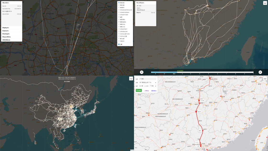
Outside of the application, many features have been developed by enthusiastic users for everyone to use. One that I frequently use is the Fog Eraser developed by Vic Wang (Universal Access, Mainland China Entry). With the eraser, you can remove offsets, import errors, and other track inaccuracies. Vic has also compiled a dedicated Fog database, which includes the aforementioned eraser, as well as Chinese railway data. If you’re not seated near a window on a high-speed train, you can download and import railway data organized by Vic. The accumulated length of railway data has reached 173,109,262 meters.
In addition, there are Fog Time Machine and Regional Achievements. Based on historical archives, the map will continuously add new tracks as the timeline progresses. Regional achievements expand the functionality of only being able to view world exploration progress in the Fog application. By importing data using the Gaode Map API and selecting the corresponding province, city, district, or county, you can view the exploration status of the corresponding area.
Tools such as importing location from photos, GPS coordinate conversion, CSV file to geographic file conversion, the 1% World Exploration Plan, Fog Bus Rankings, among others, enrich Vic’s Fog database. Searching “Fog Database” on WeChat public account provides more detailed information, where you can also submit railway data not yet included, join rankings and the 1% exploration plan, and support the author’s development services through appreciation channels.

$30.00?
The Fog of World is currently available for iOS and Android users, who can purchase it for around $30.00 on the App Store and Google Play Store. Android users are provided with a 30-day refund guarantee: if they are not satisfied with the Fog of World within 30 days, they can simply send the purchase order number from the Google Play Store to the author’s email, and the payment will be refunded. However, the refund policy for iOS users is determined by Apple. Nevertheless, if a refund was previously requested, Google and Apple may not allow users to repurchase the same application.
Therefore, the high price of $30.00 is a deterrent for many prospective users. Fog of World community members often say that in the future, they will have to go out of their way and spend much more money just to upgrade. But when considering whether to pay for an app that simply records location tracks, few compare this cost to the expenses incurred after purchase. Initially, I also didn’t understand why the Fog of World app was priced so high. From 2012 to today, it seems that prices haven’t risen so rapidly. It wasn’t until I experienced the “hardcore” after-sales service that I understood.
In 2022, I switched to an iPhone, and at that time version 3.0 was undergoing beta testing, offering a free opportunity to use it on TestFlight. At that time, the price should not have reached $30.00 yet. Just when I was happy to be able to use both Android and iOS, last April, with the release of the official version, the testing period on TestFlight reached its final 90 days, so I temporarily switched back to Android. I purchased an Android device in March 2019 for around 9.9 USD.
swipe left/right to view more images
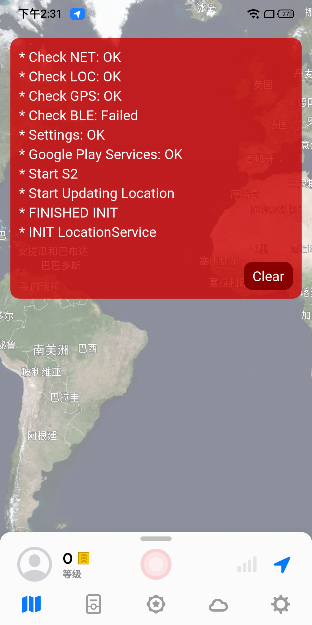
After switching back to Android, I encountered some issues, mainly related to the Google framework. While using the Fog of World to record my travels, I often found it unable to locate me. Although this was largely a problem with my phone, as other Android users could use the Fog of World normally, I emailed the app’s developer to describe the issue I was facing. We exchanged nearly a hundred emails, and he personally invited me to join the internal testing project on Google Play to assist me in identifying the cause of the location issues. During this period, he uploaded multiple test versions for me to download and visualized the log files in the app interface. Eventually, we successfully identified the problem and partially resolved my issue, allowing my phone to once again record tracks using the Fog of World.
This experience made me realize that a reliable, timely, patient, and problem-solving VIP after-sales service may also be considered an essential component of the cost of any paid software.

swipe left/right to view more images
User Experience
To me, the most joyful moments with Fog of World are when I place my phone by the window in the car, watching it gradually uncovering the fog ahead, reaching the destination, and then setting off again. It’s not just about recording tracks and reviewing them later, but more like the gaming experience it advertises on its official website. It’s akin to playing “Genshin Impact” and exploring the vast world of Teyvat. I believe this, along with the UI and features mentioned earlier, is one of the key reasons why Fog of World is chosen by many users among various apps.
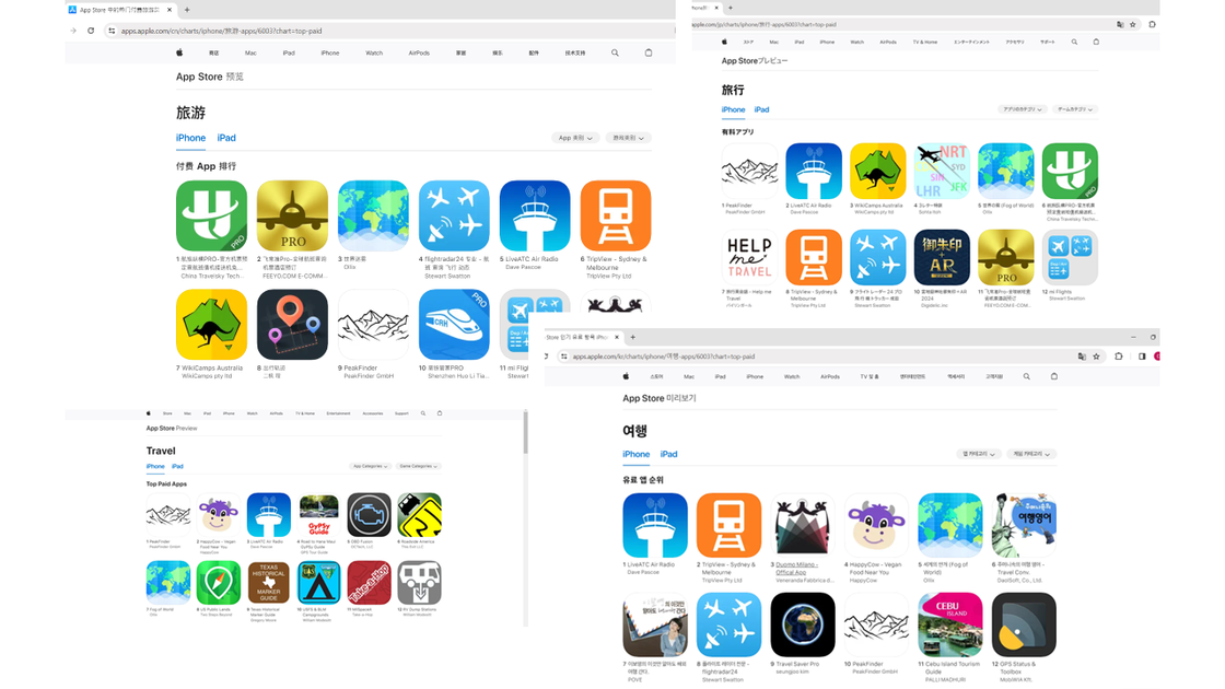
From the screenshot below, you can see that Fog of World is among the Top 10 paid apps in the travel category on the App Store across various regions such as China, the United States, Japan, and South Korea.
However, Fog of World is not the most specialized or widely popular product that brings the exploration of the world into a gaming experience. There are other games like Pokémon GO, where players venture outdoors to capture Pokémon and explore the world. Additionally, there’s Ingress Prime, which has been less known in recent years. Developed by Niantic Labs, Ingress is a multiplayer, location-based, augmented reality game based on real-world geographical conditions, where players from different factions engage in virtual territorial warfare. Pokémon GO is also a collaboration between Niantic and The Pokémon Company.
Similar Applications
In terms of user experience, there are several similar products to Fog of World, such as LifeFootprints, LingGanFootprints, and Riji. These applications provide users with features such as recording and importing footprints, with their differences mainly focusing on the display of the tracks.
LifeFootprints allows users to display tracks based on different date attributes such as today, yesterday, one week, one’s lifetime, and custom dates. Regarding map display, users can customize it according to their preferences, with nearly six map styles including blue, white, green, and pink, and over thirty types of footprint wallpapers. Users can freely adjust the colors and positions of the drawn tracks. If I hadn’t encountered Fog of World first, I might have continued using this app. The creator of LifeFootprints extensively discussed the significance, features, and functionalities of the app in an article titled “In Order to Help You Draw a ‘Life Map,’ I Created This App: Footprints (Chinese version only).” LifeFootprints can be used for free, and currently, an annual subscription membership costs only around 2 USD. However, I believe there might be some issues with the human-computer interaction aspect, as sometimes I find some operations confusing.
Furthermore, LifeFootprints is very efficient in terms of battery optimization. Friends who have used it in the Fog of World group have said that it consumes less power than Fog of World. It also supports Apple Watch, which I believe can alleviate the problem of heavy battery consumption during long-term positioning on the phone (although the battery life of Apple Watch is often criticized). I also saw on the author’s Weibo account the annual summary (Chinese version only) that LifeFootprints launched last year, which quantifies the user’s footsteps over the past year.
Obtaining My Footprints
Both Fog of World and LifeFootprints have two basic functions: obtaining footprints and displaying footprints. For obtaining footprints, these apps provide real-time location recording and post-importing. In terms of display, Fog of World’s UI has always been praised by users, while LifeFootprints also offers a variety of map templates for users to choose from.
However, these apps face the same issue when obtaining footprints: what to do if the location signal is poor or the footprint cannot be recorded at that time? In these two articles from 2017, “GPX Builder, Helping You Complete the Footprint Breaks in ‘Fog of World’ | App+1 (Chinese version only)” and “Complete Guide to Filling in Footprint Gaps in Fog of World: After Walking Through the World, What Do You Want to Leave Behind (Chinese version only),” the authors introduced some methods for filling in footprints, such as using Google Earth desktop version to draw paths, manually drawing and generating GPX files using GPX Builder, downloading flight tracks from Flightradar24 (which ceased service on July 31, 2018), and exporting from Moves (which ceased service on July 31, 2018).
Over the years, Vic Wang’s Fog Database has basically met all the expectations of users who need to record tracks, whether it’s drawing new tracks on the map, erasing existing tracks, importing Chinese railway data, adding location information from photos to tracks, using the time machine, CSV to GPX/KML conversion, Chinese coordinate conversion, and other functions. The Fog Database processes data using local browser caching, greatly reducing the risk of data leakage, but when the track data is large, it may occupy high memory and affect performance.
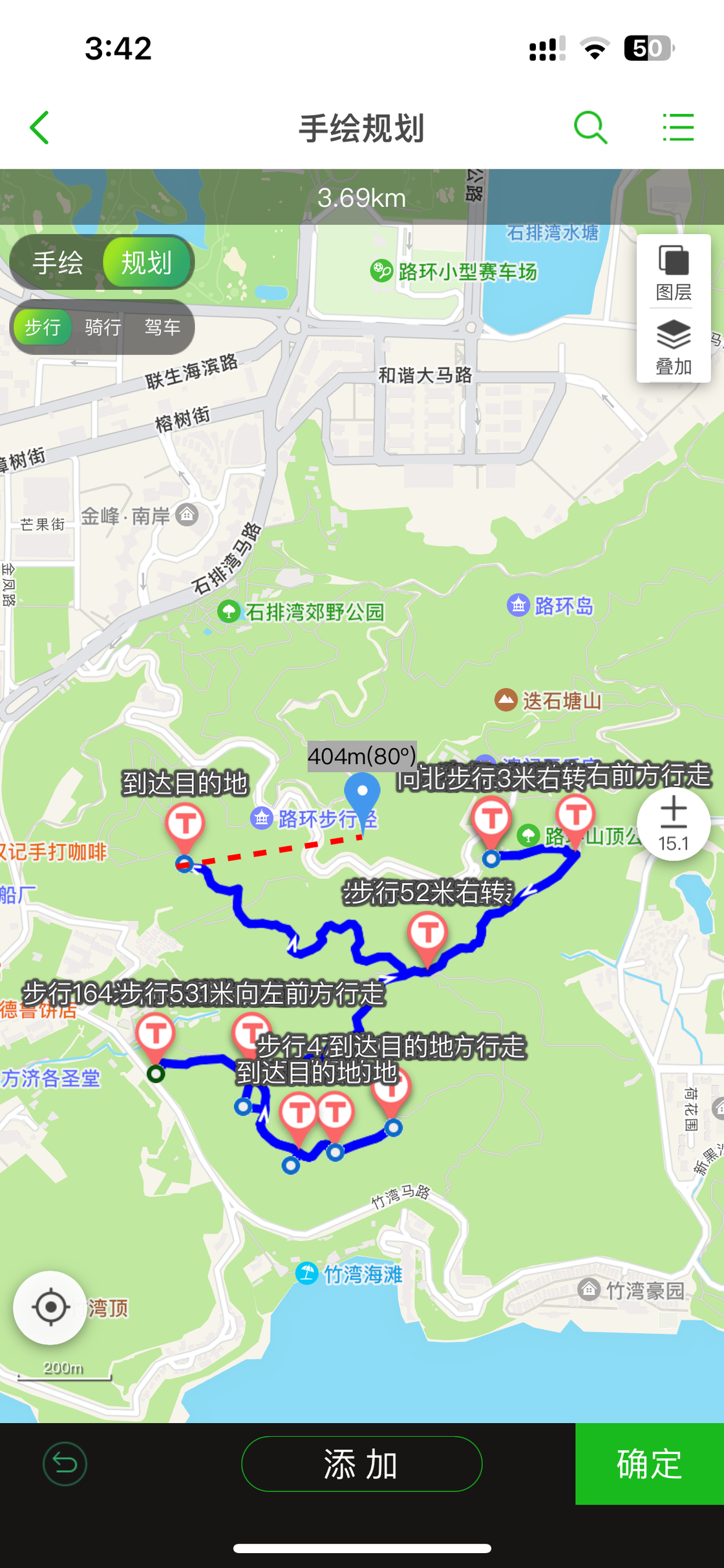
In Vic’s article “Recommendations for Some Interesting GPS Tools (Chinese version only),” he detailed various tools for data display, route drawing, and querying. Based on my own experience and other online resources, I will introduce these tools used to obtain footprints. Some of these methods record real-time location through GPS, while others involve drawing on maps, including freehand drawing and automatic drawing based on software algorithms, as well as downloading paths directly, mainly on public transportation (airplanes, trains, buses).
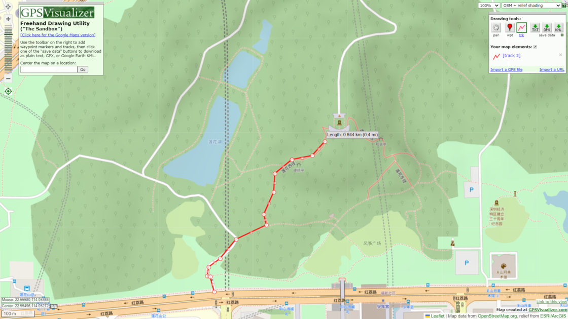
GPS Visualizer
GPS Visualizer is a practical online tool for processing geographic data that has been around since 2002. It is free and powerful, offering a wide range of functionalities such as route plotting, geographic information file conversion, calculation of distances between coordinate points, and elevation querying. In terms of plotting tracks, GPS Visualizer provides a high level of customization. For example, if you are climbing a mountain without existing routes on the map, GPS Visualizer allows you to freely draw. There are numerous map sources to choose from, with close to 80 options available. This was one of the earliest route plotting tools I used and was also recommended by the Fog of World author as one of the tools for adding paths at the beginning.
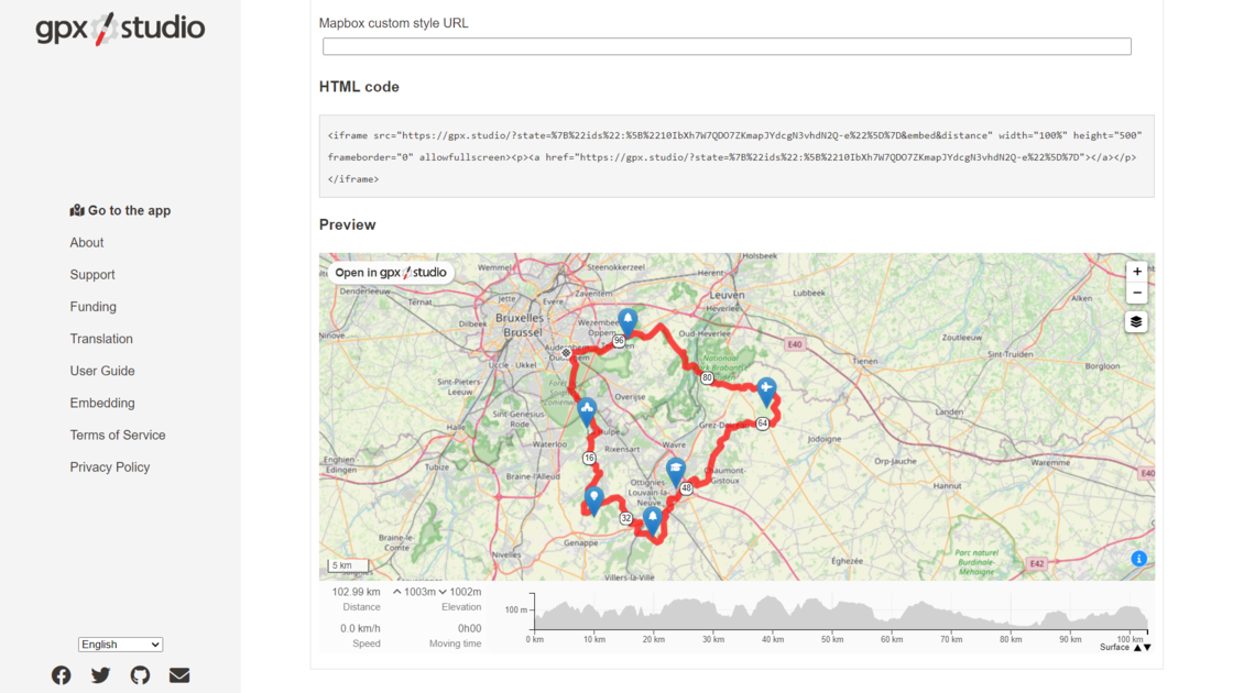
gpx.studio
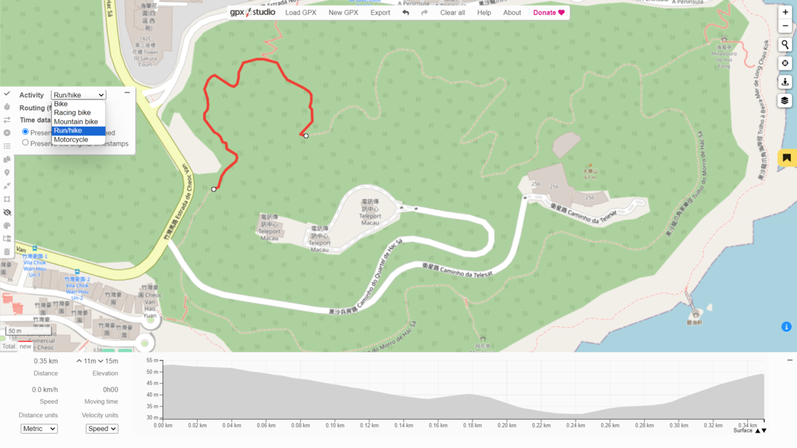
gpx.studio is a free online GPX viewer and editor. After learning about this tool from Vic’s article, I switched from GPS Visualizer to gpx.studio. Compared to GPSV, gpx.studio has an automatic road network snapping feature. This means that when drawing routes, you don’t need to worry about deviations between the drawn route and the map’s route. You only need to set the starting and ending points at appropriate distances. gpx.studio provides activities such as running, hiking, cycling, mountain biking, and motorcycling, covering almost all road networks on the map. If you deselect “Routing (follow roads),” you can draw freely without automatically snapping to the map’s roads.
gpx.studio is also a free tool, and its source code is available on GitHub. In terms of drawing routes, gpx.studio allows users to extend data such as time, heart rate, cadence, power, and temperature as needed. Editing existing tracks, including adding, deleting, and modifying, can be easily done. For specific operations, the author provides detailed explanations in the official User Guide.
Footpath
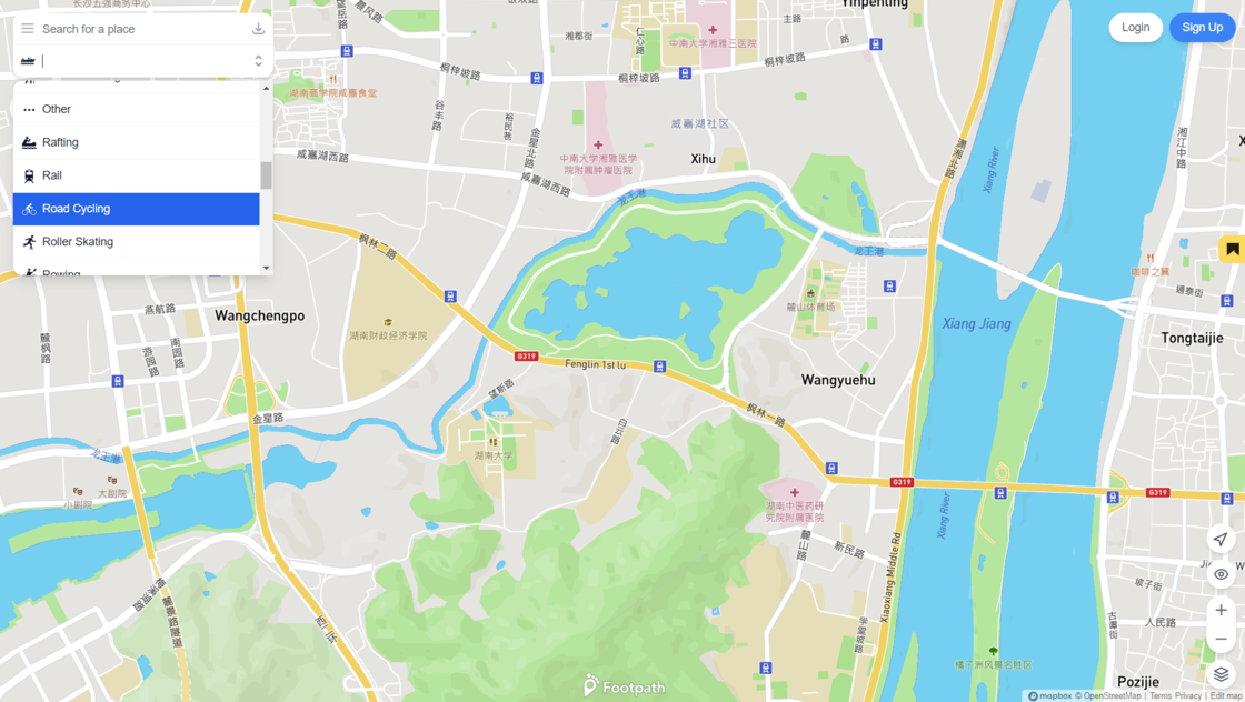
Footpath is a route planning application available for use on Android, iPhone, iPad, Apple Watch, and the Web App. Unlike the previous two tools that are only available on the web, Footpath focuses on route planning, which means providing navigation for users, making its multi-platform availability more important. Footpath allows users to draw routes with their fingers on their mobile devices. It requires account login, which enables users to synchronize their route tracks across multiple platforms.
In terms of route drawing, Footpath also supports route snapping and provides over thirty modes of transportation including driving, flying, trains, swimming, skiing, and walking. The overall UI is more modernized as well. I previously used their web service where exporting routes and other functions did not require account login. However, some features have gradually transitioned to membership-based access. Currently, Footpath offers a one-year membership subscription for $24.
Guru Maps
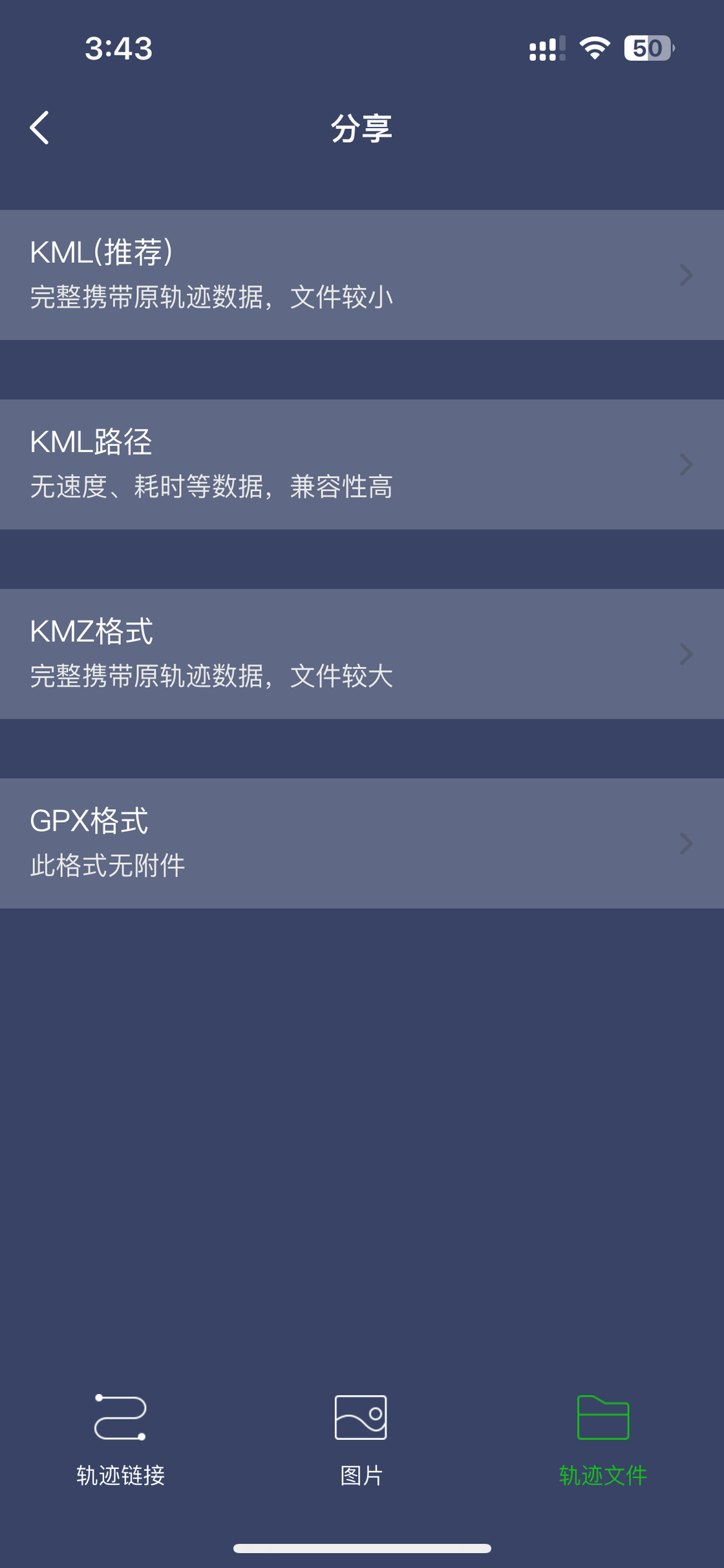
Similar to Footpath, Guru Maps is also a route planning application. However, unlike Footpath, Guru Maps does not support user-drawn routes on the map. Instead, Guru Maps utilizes optimal routing provided by the software, offline maps and search, real-time GPS tracking, and location tagging to help users plan routes. Therefore, Guru Maps primarily focuses on exporting routes planned within the app and recording actual GPS locations for obtaining tracks. In terms of route planning, Guru Maps supports various navigation modes including driving, walking, cycling, motorcycling, trucking, and straight-line (direct path) navigation. The exported file formats include KML, GPX, and CSV.
Currently, Guru Maps is available on Android, iPhone, iPad, and Mac platforms. The app also offers a Pro service, available for a one-time purchase of approximately 198 RMB for a lifetime license or a yearly subscription fee of approximately 100 RMB. The free version allows users to create a limited number of maps and paths, with a maximum of 15 fixed locations, recording 15 tracks, and downloading vector maps of up to 3 regions on the device.
swipe left/right to view more images
2BuLu
2BuLu is also a route planning application, but unlike the previous two, it adds community features beyond tool attributes. Many of my friends who enjoy hiking and mountaineering also frequently use this app. For obtaining tracks using Two Steps, similar to Guru Maps, it offers two methods: real-time location tracking to record tracks and internal route planning within the app. However, Two Steps supports hand-drawn routes and provides even higher customization options.
swipe left/right to view more images
Outdoor tools like AllTrails also support exporting their activity tracks and importing tracks, similar to Two Steps. Additionally, AllTrails provides a thoughtful track conversion tool that can convert tracks to various file formats to meet the requirements of different application platforms. Garmin’s BaseCamp also allows users to export route tracks and other data.
Flightradar24 / FlightAware
For obtaining flight tracks, aside from sitting by a window with the phone close to the window pane to record in real-time, the only other option for most users is to download from these real-time flight trackers. However, whether using Flightradar24 or FlightAware, incomplete flight tracks are often encountered. Here, I’ll use FlightAware as an example to address this issue of incomplete flight tracks.
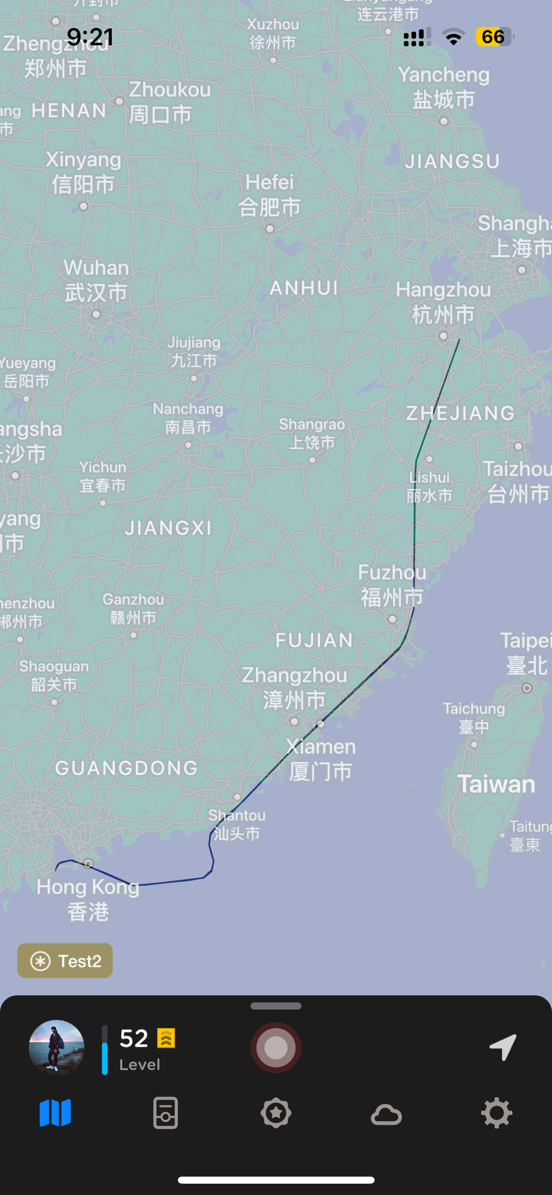
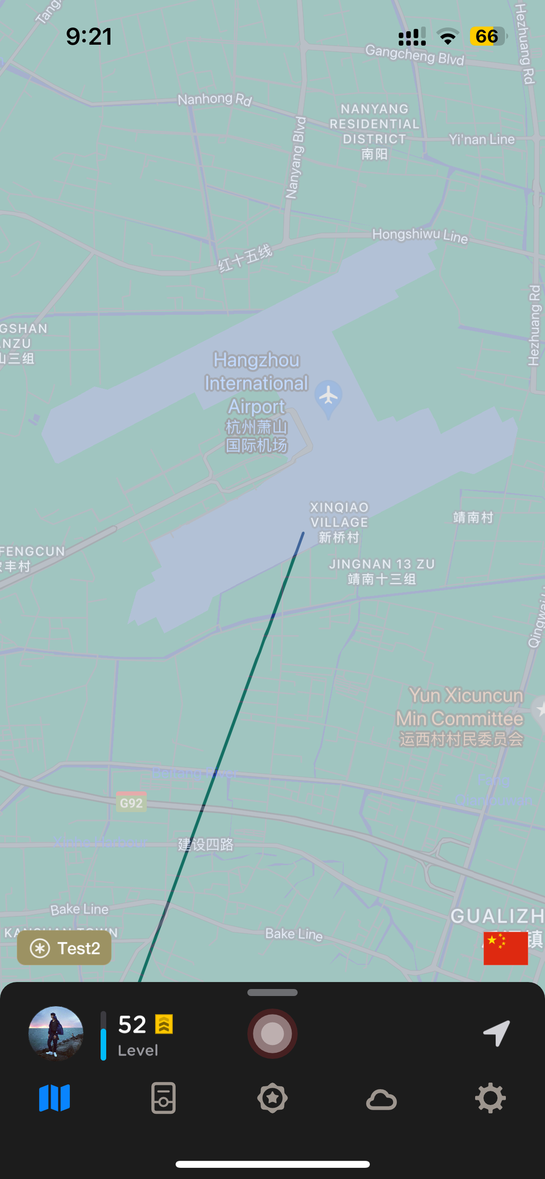
Taking the flight from Macau to Hangzhou on December 31st as an example, you can download the flight track map provided by FlightAware through the link. On the website, you can see that the track changes from green to white near Hangzhou, and when imported into a track display platform, you’ll notice that the white part of the track is missing.
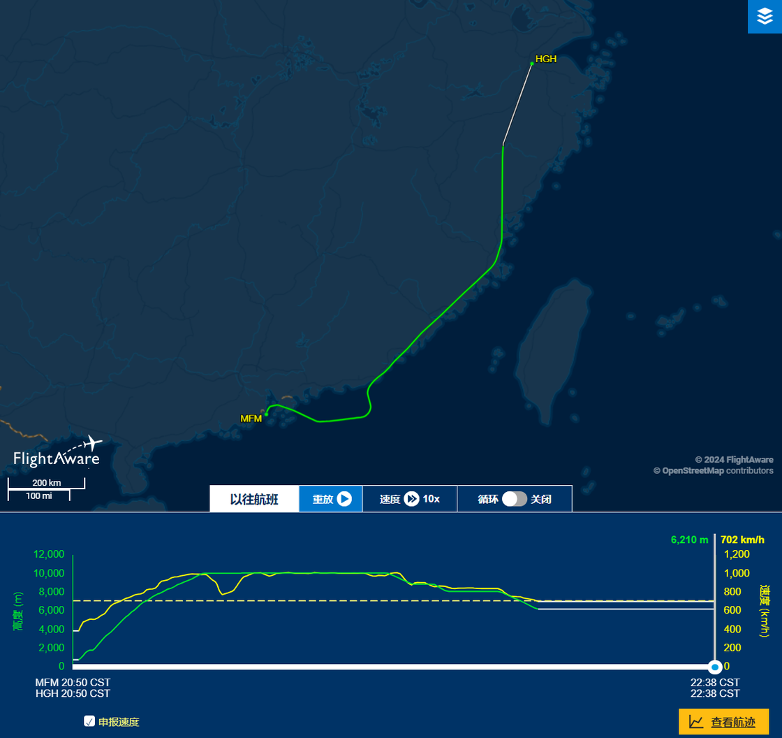
swipe left/right to view more images
Opening the KML file downloaded from FlightAware in a text editor, it can be seen that the exported flight track file coordinates only go up to 119.69346 28.43988. Similarly, on FlightAware, after the position at 28.4399 119.6935, parameters such as speed, altitude, meters, and climb rate are missing, with reported facilities being estimated values.
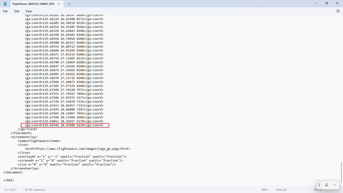
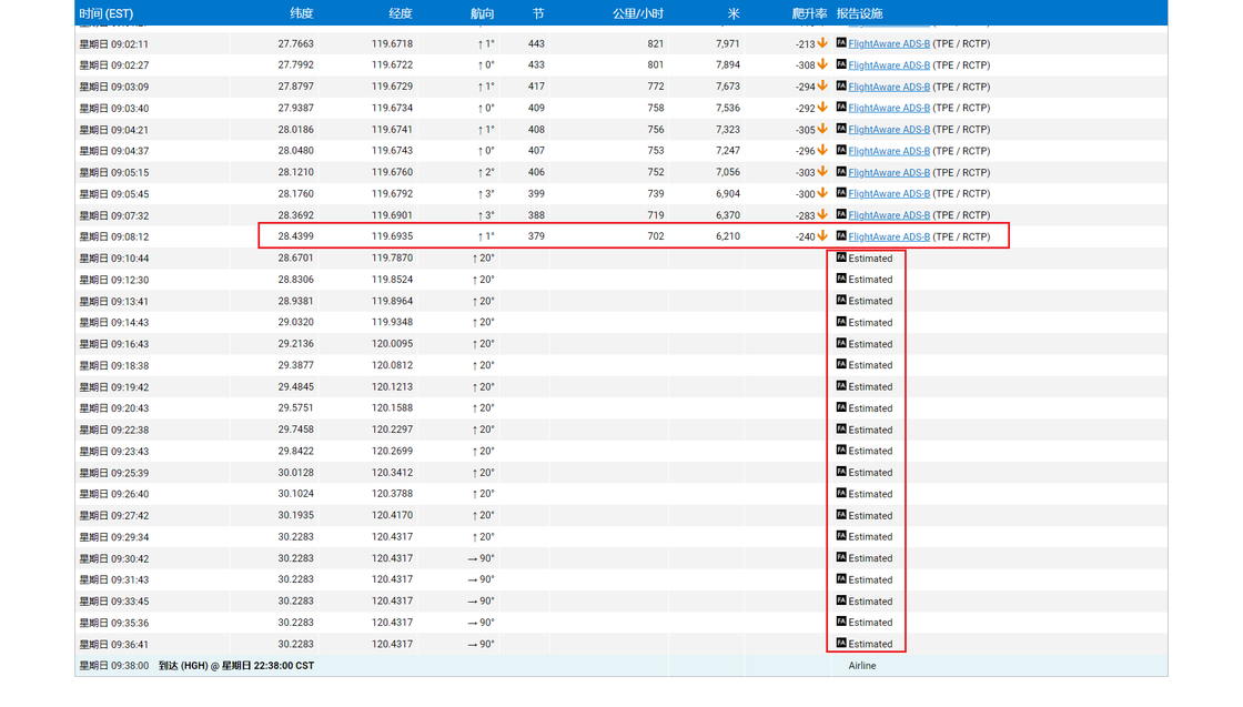
You can manually add the estimated coordinates of these reporting facilities from FlightAware to the downloaded KML file. Since most of the footprint display tools do not require altitude information, you can freely fill in the corresponding altitude when manually adding these coordinates to the KML file according to your needs.
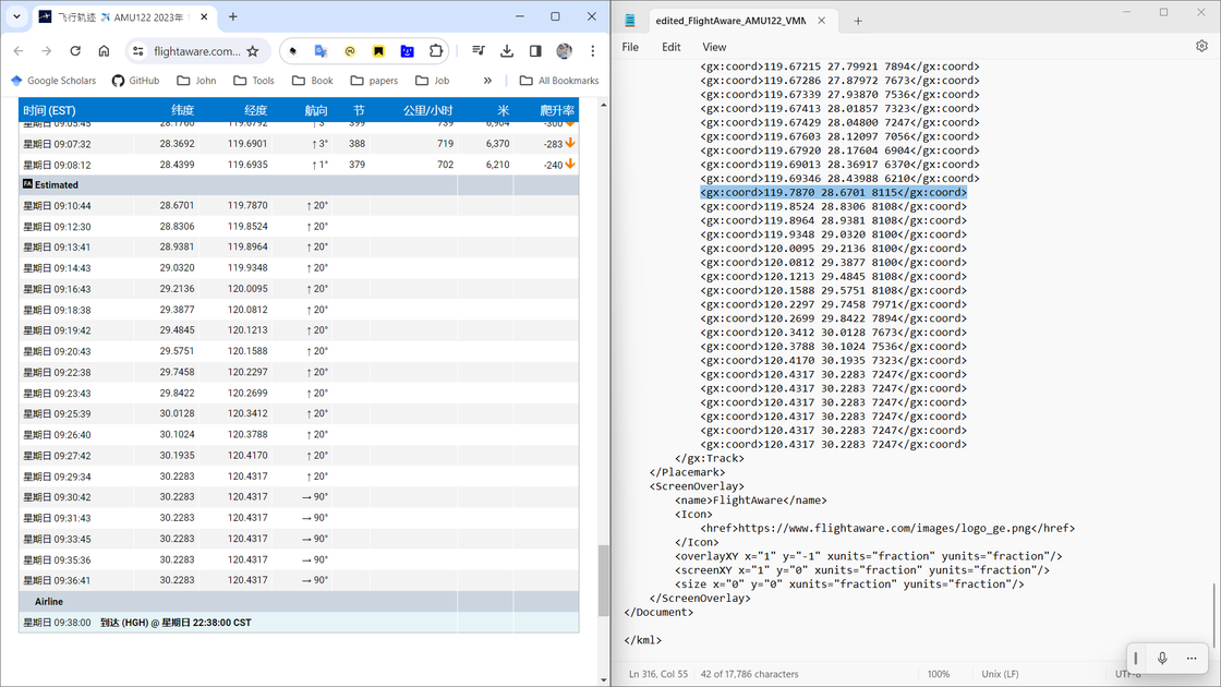
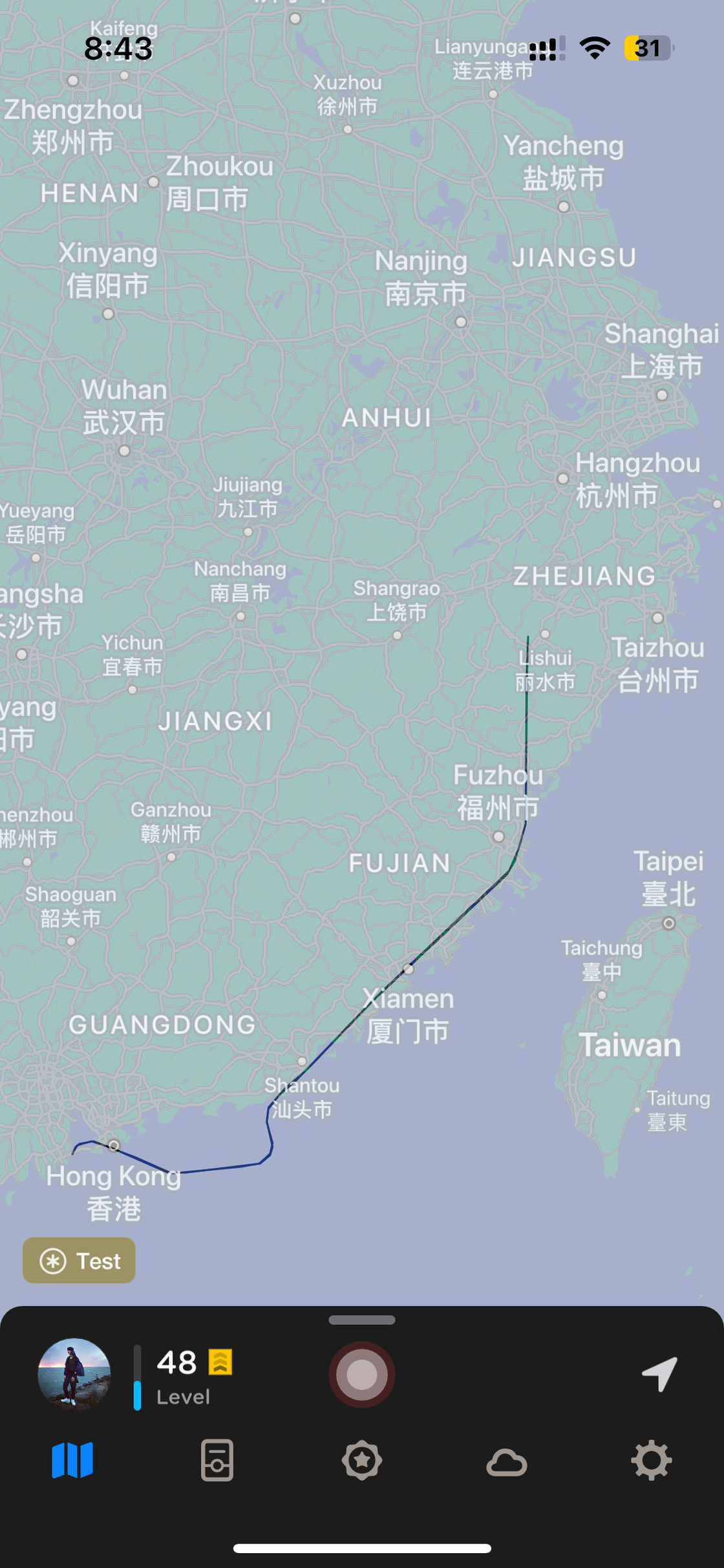
I didn’t modify the climbing height here. Instead, I copied some sections from the previous portion and pasted them over. After modifying the file, I re-imported it into the footprint display platform. Now, you can see that the white segments of the track are connected, successfully reaching Hangzhou Xiaoshan Airport. This may not be a perfect solution, but it’s worth trying on footprint display platforms that don’t require altitude information.
swipe left/right to view more images
Others
There are many other tools available for obtaining tracks. In Google My Maps, you can also export routes planned on Google Maps. However, it’s important to note that Google Maps uses a different coordinate standard from the one used in China.
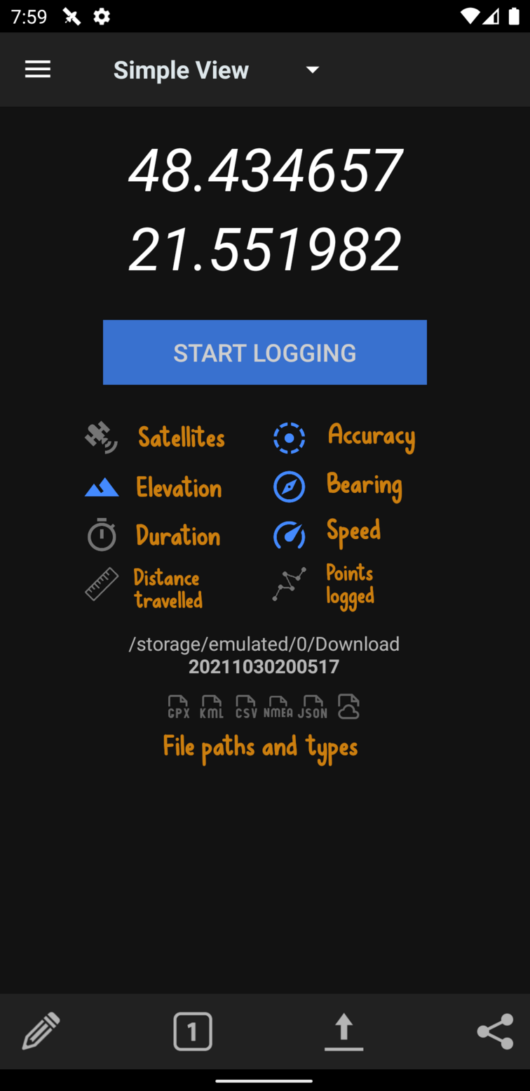
GPSLogger for Android is a very power-efficient GPS logging application. It doesn’t display maps; instead, it shows only the current latitude and longitude. Upon opening the app, you’re presented with a “Start Logging” button. The recorded coordinates can be saved in GPX, KML, CSV, NMEA, and CSV formats.
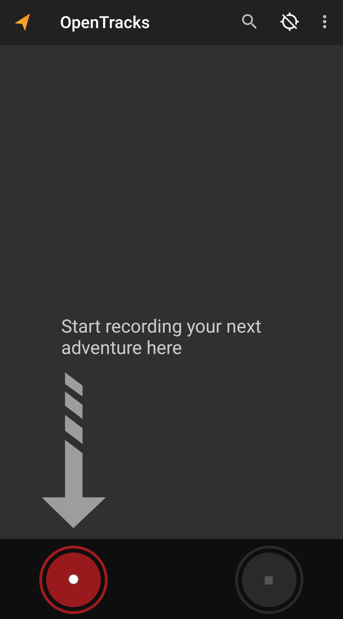
Similar to GPSLogger, OpenTracks also doesn’t provide maps within the app. However, it specializes in activity tracking. Users can add photo markers and other features to track their activities. OpenTracks also supports exporting track data in KML or GPX formats.
swipe left/right to view more images
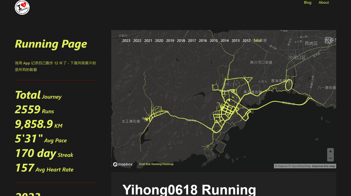
Strava also supports exporting activity tracks for running, cycling, or hiking. In the running_page project, the author provides a way to retrieve data from Strava, NRC, and other sports apps, along with impressive visualization effects. Some hardware products like Garmin, Huawei GT Runner, and Coros professional sports watches offer the option to export location tracks in GPX and other GPS data formats. X-TRACK bicycle computers also support recording and displaying real-time tracks, as well as exporting tracks in standard GPX format.
swipe left/right to view more images
Amap / Baidu Open Platform provides a wealth of data visualization solutions in the AntV of the Ant Group, some of which also provide administrative division data, public transportation, and other data. In the Shanghai Bus example, based on the data files in the code, you can obtain all the bus and subway routes in Shanghai.
Displaying My Footprints
In terms of displaying route data, among the tools mentioned for obtaining tracks, those that allow users to draw their own routes to obtain tracks also have display functionality. Because drawing requires interaction on the map, data display is also inherent. GPS Visualizer, as its name suggests, visualizes GPS data. It supports importing various types of route files, allowing users to view places they have been, plan where they want to go, and quickly visualize geographic data. Its rich map styles can also cater to a wide range of preferences. Similarly, gpx.studio offers this functionality. It’s worth noting that gpx.studio even allows users to embed tracks into their own websites, providing a variety of options for displaying track data.
Applications like Footpath, Guru Maps, and 2bulu support importing tracks, but generally, only single tracks can be imported. Therefore, there are some limitations in displaying the overall track data. Two Steps Road provides map overlay functionality, allowing multiple tracks to be displayed together on the current map.
On one hand, most track-oriented applications have excellent track display capabilities. Whether it’s World Fog, which displays tracks by eliminating fog, or Life Tracks, which offers highly customizable display effects in the form of heat maps, they can meet the needs of most users to some extent. On the other hand, displaying tracks can easily lead to the leakage of privacy data, so the options for standalone software services are limited.
Personalized track display is also related to the visualization of geographic data. AntV L7, also known as L7 Ant Group Spatial Data Visualization, is an open-source, WebGL-based large-scale spatial data visualization and analysis engine launched by the AntV Data Visualization Team of Ant Group. The project is also open-sourced on GitHub. L7 provides a large number of map templates, but one must consider that their track files need to be converted into readable formats such as CSV, JSON, GeoJSON, which essentially only contain latitude and longitude information, before they can be applied to various layer types.
swipe left/right to view more images
Apart from resources provided by map service providers, there are also some projects on GitHub aimed at better showcasing one’s footprints. dérive can generate route heatmaps based on tracks; additionally, GPX Animator can create animated videos from GPX files, displaying the movement of the tracks; GpxTrackPoster can present multiple GPX files in poster format.
Conclusion
As the title suggests, not using Fog of World, but using other similar products, can also process footprints; another meaning is that even if you use Fog of World, but cannot obtain footprints through Fog of World, you can still find methods for processing footprints in the tools mentioned above; in any case, I hope that the tools introduced here can help friends who like to record their tracks.